87 young winners awarded bicycles at Fajr Salah Competition in Mangaluru
_vb_86.jpeg)
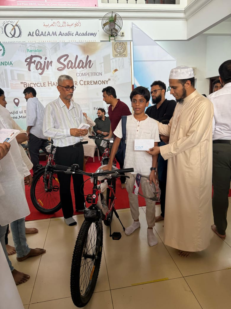
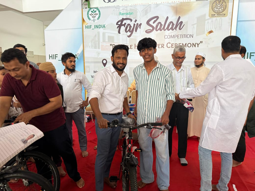
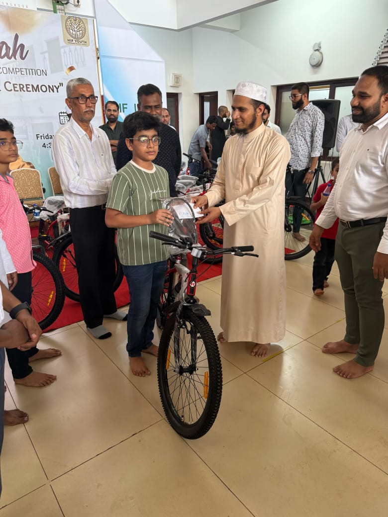
Mangaluru: HIF India organized the Fajr Salah Competition Bicycle Handover Ceremony at Masjid ul Ehssan, Vaslane, Mangalore on Friday, honouring young participants who consistently attended Fajr prayers throughout Ramadan.
A total of 87 children were awarded brand-new bicycles in recognition of their commitment, discipline, and regularity in performing the early morning prayer.
The event was attended by several distinguished guests, including Moulana Thyab, Khateeb of Masjid ul Ehssan, who served as the Chief Guest. Other notable attendees included Dr. Rizwan, leading orthopedic surgeon; Dr. N.A. Mohammed, eminent ENT surgeon; Adil Parvez, President of HIF India; Shaaz A.K., President of HIF Youth; and Muthalib, Managing Director of Taj Cycles, Mangaluru.
The program began with a recitation of the Holy Qur'an by Master Aahil SM, followed by anchoring done by Ruhaan Ismail.
Shaaz Rasheed introduced the audience to the vision, mission, and various initiatives of HIF India, encouraging greater community involvement and youth development.
Moulana Thyab, in his address, highlighted the importance of Salah, particularly the Fajr prayer, in shaping the moral character and future of the youth. His speech left a profound impact on the gathering.
Dr. Rizwan, in his remarks, urged the children to maintain discipline across all areas of life, emphasizing the balance between education, health, and religious obligations.
The ceremony concluded with the distribution of bicycles to the winners. HIF India extended its gratitude to all the guests, volunteers, parents, and community members whose contributions ensured the success of the event.


Let the Truth be known. If you read VB and like VB, please be a VB Supporter and Help us deliver the Truth to one and all.
Ordinance issued to increase number of Supreme Court judges from 34 to 38

New Delhi (PTI): The government has promulgated an ordinance to increase the strength of the Supreme Court from the present 34 judges to 38, including the Chief Justice of India.
The law ministry notified the ordinance on Saturday, which amended the Supreme Court (Number of Judges) Act, 1956, to increase the sanctioned strength of the top court.
So far, the sanctioned strength of the top court was 34, including the Chief Justice of India (CJI). Now, the number of judges has been increased by four, taking the sanctioned strength to 38.
The top court will now have 37 judges, other than the CJI.
With the apex court having two vacancies at present, and the ordinance coming into force immediately, the Supreme Court Collegium will now have to recommend six names for appointment as judges in the top court.
A bill will be brought in the Monsoon Session of Parliament to convert the ordinance – an executive order – into a law passed by Parliament.
The Union Cabinet had cleared a draft bill on May 5 to increase the number of apex court judges.
The strength of the Supreme Court was last increased from 30 to 33 (excluding the CJI) in 2019.
The Supreme Court (Number of Judges) Act, as originally enacted in 1956, put the maximum number of judges (excluding the CJI) at 10.
This number was increased to 13 by the Supreme Court (Number of Judges), Amendment Act, 1960, and to 17 by another amendment to the law.
The Supreme Court (Number of Judges) Amendment Act, 1986, augmented the strength of judges from 17 to 25, excluding the CJI.
A fresh amendment in 2009 further increased the strength from 25 to 30.
Article 124(3) of the Constitution lists the qualifications required to become a Supreme Court judge.
An Indian citizen who has either served as a high court judge for at least five years, or as an advocate for 10 years, or is a distinguished jurist, can be appointed to the top court.
The strength of the Supreme Court is increased based on the recommendations of the CJI, who writes to the Union law minister. After consulting the finance ministry, the Department of Justice under the law ministry moves the Cabinet with a draft bill.


