Bearys Institute of Technology observes World Earth Day with focus on sustainability

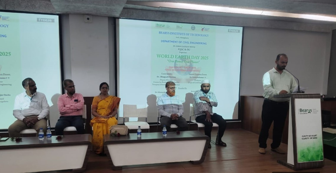
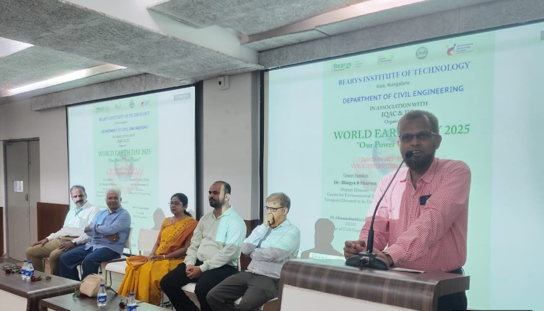
Mangaluru, April 28: Bearys Institute of Technology (BIT), Mangalore, marked World Earth Day 2025 with a special programme organised at the International Seminar Hall on Monday. The event, conducted by the Department of Civil Engineering and Basic Science, was held under the theme “Our Power, Our Planet,” highlighting the need to protect the environment and adopt sustainable lifestyles.
The keynote address was delivered by Dr. Bhagya B. Sharma, Deputy Director at the Centre for Environmental Studies, Yenepoya (Deemed to be University). Speaking on the topic “Powering the Future: The Earth Day Call to Action,” she encouraged students to explore clean energy solutions and take innovative steps to protect the planet.
Following her address, Dr. Purushothama C.T. from the Civil Engineering Department delivered a talk on “Sustainability: The Revolution Earth Needs,” where he discussed practical approaches to face environmental challenges and called for urgent action to adopt eco-friendly practices.
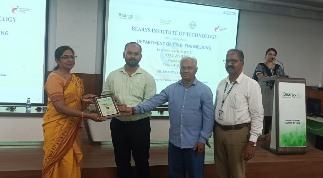
The programme began with a welcome by Dr. Altamashuddin Khan, Head of the Civil Engineering Department, who urged students to take active roles in conservation efforts. Principal Dr. S. I. Majur Basha shared a message emphasising the power of individual responsibility in preserving the environment through small, consistent efforts.
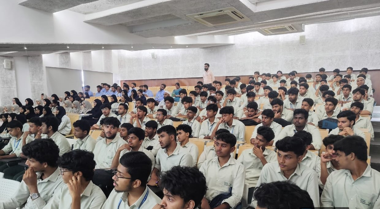
Over 200 students and faculty members took part in the programme, which sparked productive discussions and encouraged participants to contribute to a greener future.
The event concluded with a Vote of Thanks by Dr. Pooja K, Assistant Professor in the Civil Engineering Department. She thanked all the speakers, organisers, and attendees for their support and participation.
The programme was coordinated by Dr. Purushothama C.T. and Mr. Zaheer Ahmed from the Civil Engineering Department.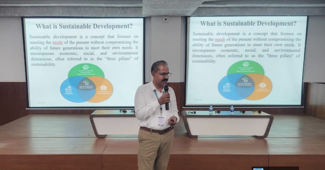


Let the Truth be known. If you read VB and like VB, please be a VB Supporter and Help us deliver the Truth to one and all.
Ordinance issued to increase number of Supreme Court judges from 34 to 38

New Delhi (PTI): The government has promulgated an ordinance to increase the strength of the Supreme Court from the present 34 judges to 38, including the Chief Justice of India.
The law ministry notified the ordinance on Saturday, which amended the Supreme Court (Number of Judges) Act, 1956, to increase the sanctioned strength of the top court.
So far, the sanctioned strength of the top court was 34, including the Chief Justice of India (CJI). Now, the number of judges has been increased by four, taking the sanctioned strength to 38.
The top court will now have 37 judges, other than the CJI.
With the apex court having two vacancies at present, and the ordinance coming into force immediately, the Supreme Court Collegium will now have to recommend six names for appointment as judges in the top court.
A bill will be brought in the Monsoon Session of Parliament to convert the ordinance – an executive order – into a law passed by Parliament.
The Union Cabinet had cleared a draft bill on May 5 to increase the number of apex court judges.
The strength of the Supreme Court was last increased from 30 to 33 (excluding the CJI) in 2019.
The Supreme Court (Number of Judges) Act, as originally enacted in 1956, put the maximum number of judges (excluding the CJI) at 10.
This number was increased to 13 by the Supreme Court (Number of Judges), Amendment Act, 1960, and to 17 by another amendment to the law.
The Supreme Court (Number of Judges) Amendment Act, 1986, augmented the strength of judges from 17 to 25, excluding the CJI.
A fresh amendment in 2009 further increased the strength from 25 to 30.
Article 124(3) of the Constitution lists the qualifications required to become a Supreme Court judge.
An Indian citizen who has either served as a high court judge for at least five years, or as an advocate for 10 years, or is a distinguished jurist, can be appointed to the top court.
The strength of the Supreme Court is increased based on the recommendations of the CJI, who writes to the Union law minister. After consulting the finance ministry, the Department of Justice under the law ministry moves the Cabinet with a draft bill.


