Wary of cyclone, Odisha begins preparations
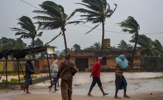
Bhubaneswar (PTI): After being hit by summer cyclones for three consecutive years since 2019, the Odisha government began preparations for any such eventuality this season even as the IMD forecast no possibility of a low-pressure area over the Bay of Bengal in a fortnight.
The government decided to open a round-the-clock control room across the districts from May 1 for monitoring the situation, a senior official said.
The decision was taken at a high-level meeting chaired by Chief Secretary P K Jena on Wednesday where the state government's preparedness was reviewed.
Senior officers of several government departments, the Director General of Police, the Director General of Fire Service, the Special Relief Commissioner, and a senior official of IMD Bhubaneswar were among those who attended the meeting.
Jena asked line departments like Revenue and Disaster Management, Rural Development, Housing and Urban Development, Health, Home, and Panchayati Raj and Drinking Water to be prepared in case a summer cyclone hits the state.
Discussions were held on information from Doppler radars installed at Paradeep and Gopalpur. These two radars will help track any summer cyclone formed over the Bay of Bengal.
While Odisha encountered cyclone Fani in 2019, cyclones Amphan and Yaas hit the state in 2020 and 2021, respectively. However, there was no such cyclone last year.
While the telecom operators have introduced several measures to deal with the devastations caused by cyclones, the state government asked them to ensure uninterrupted services and send alerts to people regarding cyclone updates.
IMD officials and senior weather scientist US Dash, who attended the meeting, said that steps have been taken for broadcasting weather bulletins and cyclone updates through radio and television channels.
He said the state government was informed that there was no possibility of any low-pressure formation in the Bay of Bengal in the next 15 days, and therefore no possibility of a summer cyclone now.
"Cyclone mock drills will be held in each district on June 18 and 19 except Puri where a festival will be held on June 20," an official said.
The officials of 317 fire stations in the state have been kept ready to face any eventuality.
At least 17 teams of NDRF can be deployed for rescue and rehabilitation work in case of any cyclone hitting Odisha this summer, a statement issued by the chief secretary's office said.
The state has altogether 879 multipurpose cyclone/flood centres to provide temporary shelters to people. The Odisha State Disaster Management Authority has been asked to keep all equipment ready for rescue and rehabilitation work, it said.
The Water Resources Department has been told to introduce the necessary measures to manage flood-like situations during the cyclone.
The Health and Family Welfare Department will store adequate medicines, anti-venom injections and other essential items at the district headquarters hospitals, the statement said.
The Food Supplies and Consumer Welfare Department has been asked to store adequate amounts of dry food and other essential commodities.
Let the Truth be known. If you read VB and like VB, please be a VB Supporter and Help us deliver the Truth to one and all.
Six foreign nationals held for alleged prostitution in Bengaluru

Bengaluru (PTI): Six foreign women were arrested after they were found to be allegedly engaged in illegal activities by soliciting men in a public place for prostitution, police said on Tuesday.
The arrests were made by the Women Protection Wing of the Central Crime Branch (CCB) on April 24, they said.
Police, however, have not disclosed the nationalities of the women in the statement.
According to police, the operation was carried out following a tip off that some foreign women were standing near the footpath of the bus stop close to Madiwala Check Post, within the jurisdiction of Koramangala Police Station here and were soliciting men passing by on the road for prostitution.
Based on this information, the officers and staff of the CCB Women Protection Wing immediately visited the spot and conducted a verification, they said.
During the operation, it was found that six foreign women were engaging in illegal activities by soliciting men in a public place for prostitution, a statement issued by the office of the police commissioner stated.
Acting swiftly, the officers and staff conducted a raid and secured all six foreign women. Upon inquiry regarding their passports and visas, they failed to provide valid and satisfactory information, it said.
"Subsequently, all six foreign women were produced before the Koramangala Police Station along with a report for further legal action. In this regard, a case has been registered at Koramangala Police Station, and further investigation is in progress," the police statement added.