Online payment system launched in Mangaluru to collect rent on MCC properties
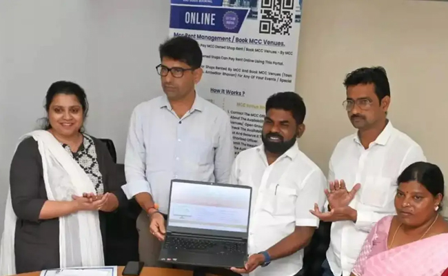
Mangaluru: A digital payment system was officially launched on Thursday by Mangaluru City Corporation Mayor Manoj Kumar at the MCC office on Thursday for collection of rent from tenants of MCC properties, including commercial complexes, market areas, function venues and open areas.
The MCC earns revenue of Rs 3.4 crore annually from the 1,070 shops it owns in 30 markets on Kudmul Ranga Rao Road, Town Hall, Dr. BR Ambedkar Bhavan and open grounds at Urwa, Kadri, Yemmekere, Jeppu, Kavoor, and the Nehru Maidan, reports Times of India.
Tenants on all such areas may pay their rent through www.mccportal.in, instead of physically visiting the MCC office. This new system also enables shop owners in the markets to settle their rental dues through the web portal.
The mayor, however, clarified that people who wished to book open grounds and function halls would have to visit the MCC office, where the staff will handle the online booking on their behalf. He further explained that the rule was implemented as a precautionary measure, as permitting direct online bookings could potentially lead to misuse and deliberate blocking of these facilities.
Manoj Kumar said that a private firm had developed the new online payment system at a cost of Rs 3.5 lakh.
MCC officials opined that the use of an online payment system would prevent any act of corruption. A QR code might also be introduced by the Corporation to prevent unauthorized hoardings within Mangaluru City limits. While the MCC earns an annual rent up to Rs 2.5 crore from hoardings, a survey of the hoardings was launched and people who had taken the hoardings on rent were asked to submit details to the Corporation officials, they added.
Let the Truth be known. If you read VB and like VB, please be a VB Supporter and Help us deliver the Truth to one and all.
Chhattisgarh coal levy scam: Rs 4 crore assets of suspended IAS officer attached
Raipur (PTI): The Economic Offences Wing (EOW) has attached properties of Rs 4 crore belonging to suspended IAS officer Sameer Vishnoi, an accused in a coal levy scam, for allegedly amassing assets beyond his known sources of income, officials said.
The EOW had registered a disproportionate assets case against Vishnoi in July 2024, an official release said on Saturday.
During the investigation, the agency identified nine immovable properties, valued at around Rs 4 crore, allegedly acquired through illicit means in the names of Vishnoi’s family members and associated firms, it said.
“An application seeking attachment of these properties was filed before the Special Court under the Prevention of Corruption Act in Raipur. Following a hearing on April 17, the court ordered attachment of all such properties,” the statement said.
Accordingly, the Anti-Corruption Bureau/Economic Offences Wing attached the properties. The attached properties cannot be sold or transferred, it said.
The Enforcement Directorate (ED) had earlier provisionally attached five immovable properties linked to Vishnoi in connection with the coal levy scam, it added.
Proceedings are also underway in cases involving other public servants, including action taken in September last year against properties linked to Saumya Chaurasia, who was deputy secretary in the chief minister’s office during the Congress government, the statement said.
Vishnoi, a 2009-batch Indian Administrative Service officer, was first arrested in 2022 by the ED in connection with the alleged coal levy scam. He was among several accused who were granted bail last year by the Supreme Court.
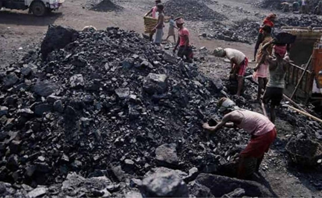
The case refers to an alleged Rs 540 crore racket between July 2020 and June 2022, when an illegal levy of Rs 25 per tonne was being extorted by a cartel involving senior bureaucrats, businessmen, politicians and middlemen for every tonne of coal transported in the state.